History
Introduction
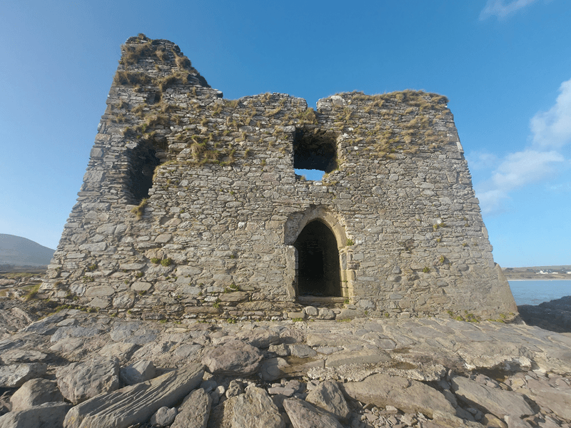
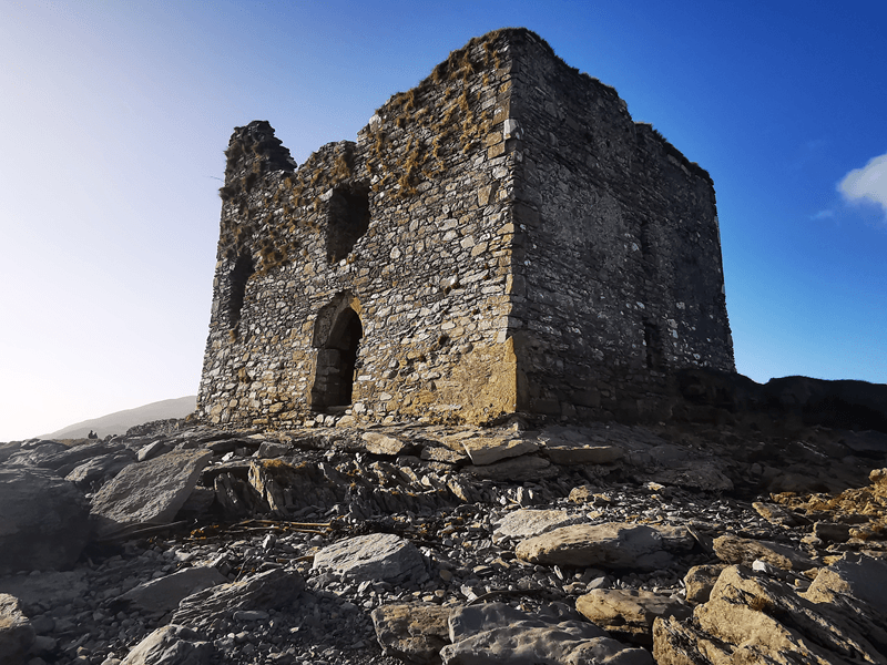
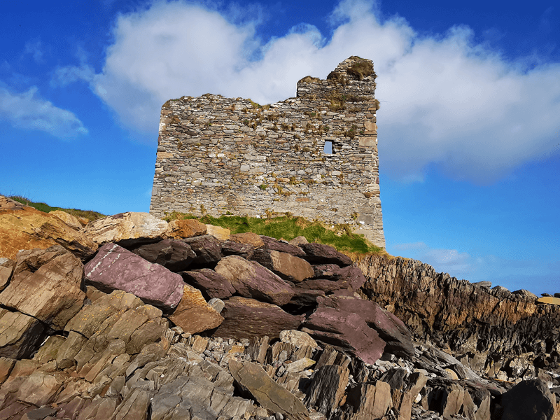
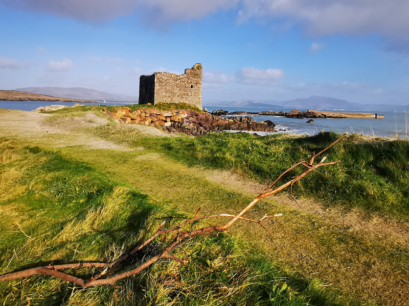
Ballinskelligs Castle, also known locally as McCarthy Mór's Tower, stands on a narrow promontory projecting into Ballinskelligs Bay on the western shore of the Iveragh Peninsula in County Kerry. The surviving structure is a small rectangular tower house, now substantially ruined, whose position at the edge of the bay gave it an unusually close relationship with the sea. The monument is recorded by the National Monuments Service as KE097-034 and is described as a tower house in ruins [1].
Very little documentary information survives concerning the castle itself. The National Monuments Service notes that it is traditionally regarded as a MacCarthy castle and that it may be identifiable with the manor occupied by the Sigerson family in Ballinskelligs during the early seventeenth century. Its history appears to have been closely connected with that of the nearby Augustinian priory, particularly during the later sixteenth and seventeenth centuries [1].
The traditional interpretation places the construction of the tower in the sixteenth century, during the period when the MacCarthy Mór dynasty dominated much of south-west Munster. Local tradition associates the castle with the defence of Ballinskelligs Bay against pirates and with the collection of dues from ships entering the bay, although the precise documentary evidence for these functions is limited [2].
Archaeological investigation has nevertheless provided a much firmer understanding of the castle's development. Excavations carried out in 1988 and 1991 revealed the original floor of the tower, its foundation trenches and two later external structures. Most of the excavated material was post-medieval, and the later structures appear to have been associated with activity connected with the coastal fishing industry [3], [4].
The landscape before the castle
Ballinskelligs was already an important centre long before the construction of the tower house. The nearby Augustinian priory was founded in 1210 by canons from Rattoo in north Kerry and provided a mainland religious settlement for the Skellig monks. The establishment of the priory reflects the continuing importance of the Ballinskelligs area as a religious and maritime centre on the western edge of Kerry [5].
The priory remained in use for centuries and its history became closely intertwined with the changing political and economic circumstances of the surrounding district. It was still occupied in the sixteenth century, but the religious house was ultimately abandoned following the Reformation and the dissolution of the monasteries under Elizabeth I [5].
The castle was therefore constructed within an already established landscape of ecclesiastical settlement, agriculture, fishing and maritime activity. Its location on the shore of the bay was particularly advantageous because it allowed its occupants to observe the coastal approaches while remaining close to the settlement and religious complex at Ballinskelligs [1].
The MacCarthy Mór tower
The castle is traditionally attributed to the MacCarthy Mór dynasty, the powerful Gaelic lordly family whose territories extended across large parts of south-west Munster. Local heritage sources describe the surviving tower as possibly sixteenth-century in date and identify it as a reputed MacCarthy stronghold [2].
A more romantic local tradition places the castle much earlier, in the twelfth or thirteenth century, associating it with conflicts between the MacCarthy rulers of Desmond and the Fitzgerald Earls of Desmond. There is, however, no secure archaeological evidence for dating the surviving tower to that early period. The accepted interpretation is that the present structure is a later medieval or early post-medieval tower house, probably belonging to the sixteenth-century MacCarthy building programme [1], [2].
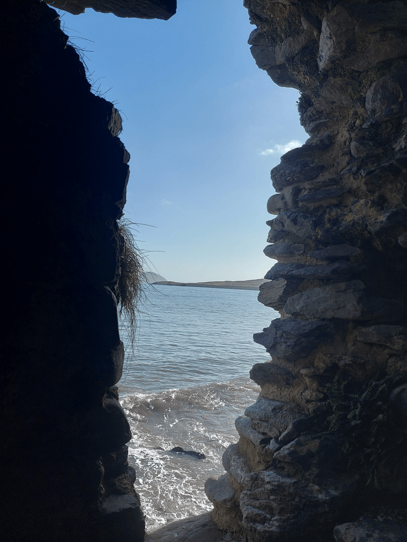
The castle's position helps explain why such a structure was built here. The tower occupies the end of a low, narrow projection of land extending into Ballinskelligs Bay, giving it an excellent view over the water. The location would have allowed the occupants to monitor vessels approaching the bay and to exercise a degree of control over maritime traffic [2].
Local tradition further states that the tower was intended to protect the bay against pirates and possibly to collect a charge from incoming trading vessels. These claims fit the broader maritime role of the MacCarthy coastal tower houses of south-west Munster, but they should be treated as traditional explanations rather than as functions demonstrated by surviving contemporary documentation [2].
The tower house and its defensive design
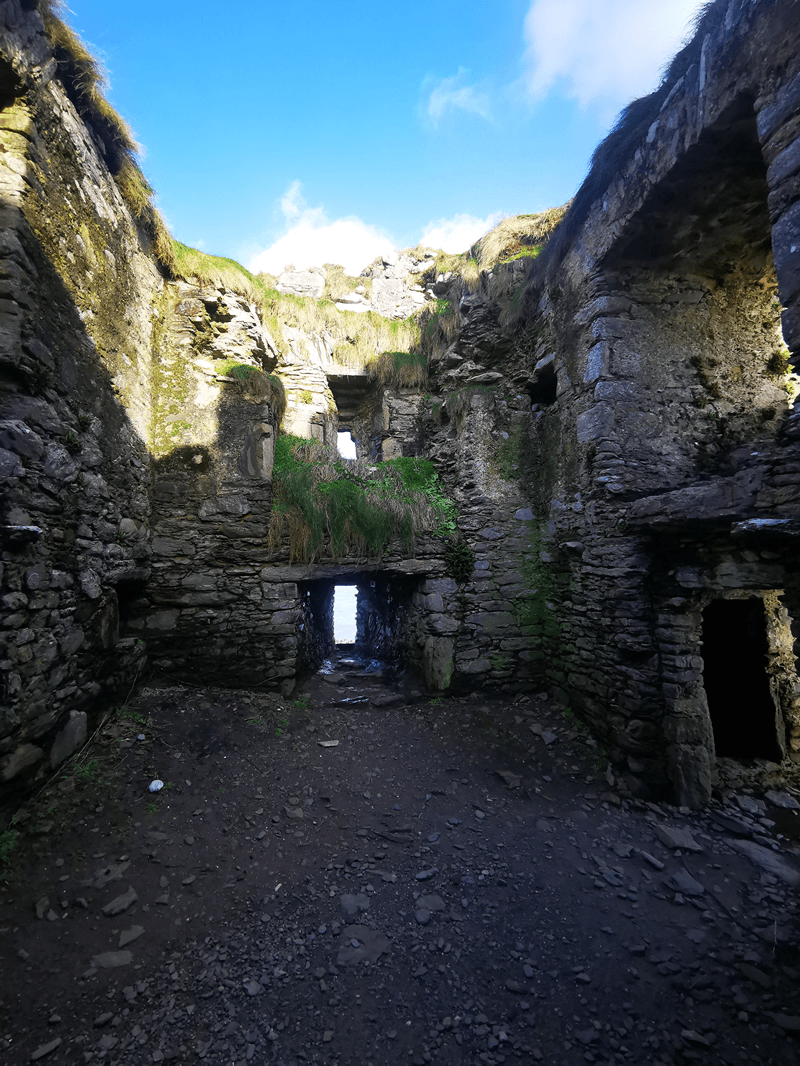
The surviving tower is rectangular in plan. At present ground level it measures approximately 10.35 metres from north-east to south-west and 8.25 metres from north-west to south-east. It originally rose through three storeys, although only part of the upper structure survives. The walls are particularly substantial at the base, where they average about two metres in thickness, and the building rises from a noticeably battered base [1].
The walls were constructed from split stone set in a strong mortar containing small marine shell inclusions. Dressed sandstone was used for the quoins and for the principal doorway. Much of the original external stone dressing has been lost, but the entrance remains one of the best-preserved architectural features of the ruin [1].
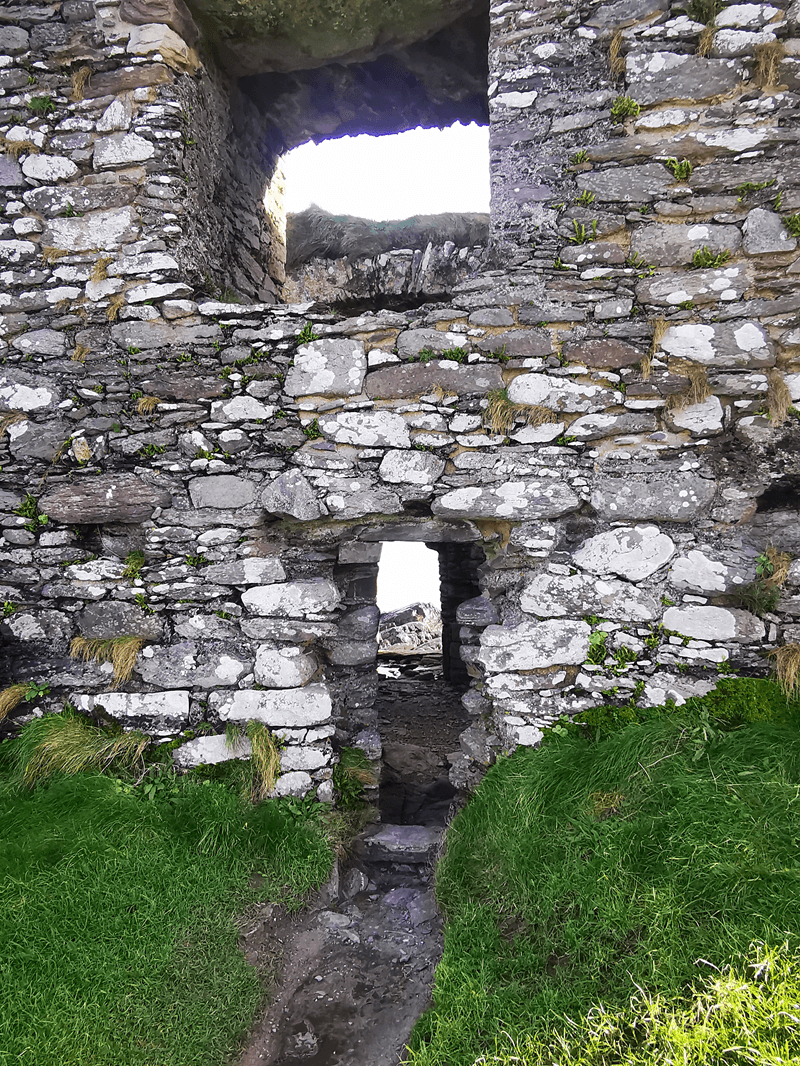
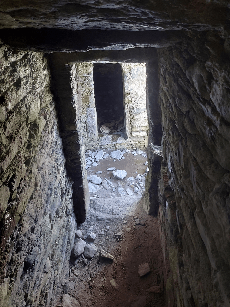
The entrance is positioned slightly off-centre in the south-eastern wall. The doorway has a pointed head and was designed with several layers of security. It could be closed by a wooden door and externally by a hinged grille, while a drawbar provided additional protection from inside. A narrow opening allowed a chain connected with the grille to be operated from an internal mural chamber [1].
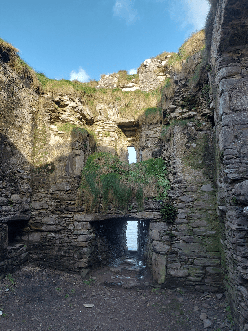
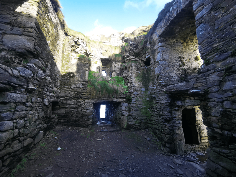
Immediately inside the entrance is a small lobby containing a murder hole. This opening was positioned beneath the first-floor window embrasure and would have allowed defenders above to attack anyone attempting to force the entrance. A small mural chamber opens from the lobby and is traditionally known by the Irish name Seomra an Bhoduig [1].
The ground-floor chamber is approximately 6.2 metres by 3.85 metres and was lit by narrow defensive loops. Wall cupboards survive in several corners, while the doorway leading into the chamber could also be secured with a drawbar. The combination of a protected entrance, mural chamber, murder hole and narrow loops gives the ground floor a strongly defensive character [1].
Access to the upper floors was provided by a mural stair beginning in the entrance area and continuing through the thickness of the south corner of the building. At first-floor level the stair opens into a mural passage, from which the principal chamber could be entered. The upper rooms were better lit than the ground floor, with larger window openings and evidence that at least some of the walls were plastered [1].
The architectural arrangement demonstrates the dual character of the Irish tower house. Ballinskelligs was designed to provide protection in an insecure political environment, but it was also intended as a residence. The lower level was heavily defended, while the upper floors provided more comfortable accommodation with larger windows, plastered interiors and private circulation within the thickness of the walls [1].
The later sixteenth century
During the later sixteenth century the political structure of south-west Ireland was changing rapidly. The traditional authority of Gaelic lordships was being challenged by the expanding Tudor administration, while the dissolution of religious houses altered the ownership and control of land throughout the region. Ballinskelligs Priory, immediately nearby, was particularly affected by these developments [5].
The documentary references relating to the priory provide an important context for the castle. The National Monuments Service notes references to the leasing and garrisoning of the priory during the later sixteenth century, including entries in the Calendar of Carew Manuscripts and the Elizabethan fiants. The castle itself is not as richly documented, but its close geographical and historical relationship with the priory suggests that both formed part of the same changing estate landscape [1].
Following the suppression of the priory, its lands passed through a succession of leases and owners. Heritage Ireland records that the priory was leased to Gyles Clinsher in 1578 and subsequently to John Blake, before the property eventually became associated with the Harding and Sigerson families [5].
This change in ownership is significant for the history of Ballinskelligs Castle because later evidence identifies the tower with the manor occupied by the Sigerson family in the early seventeenth century. The castle therefore appears to have survived the transformation from Gaelic lordship to a more conventional estate landscape rather than simply disappearing with the decline of the MacCarthy political order [1].
The Sigerson family
By the early seventeenth century the castle appears to have been associated with the Sigerson family. The National Monuments Service identifies Ballinskelligs Castle as a possible match for the manor occupied by the Sigersons during this period, although the identification is expressed cautiously because the surviving documentary evidence is limited [1].
Local tradition gives a colourful account of how the Sigersons acquired their position at Ballinskelligs. According to the story, Christopher Sigerson was due to marry a daughter of Richard Harding of Bristol. When he arrived in Bristol, however, he encountered the funeral procession of his intended bride, who had died before the marriage. Harding nevertheless treated Sigerson as though the marriage had taken place and granted him the manor of Ballinskelligs, together with the former priory and its lands [5].
The story should be understood as family tradition rather than as independently established fact. What is more securely supported is the association of the Sigerson family with the Ballinskelligs manor in the early seventeenth century and the identification of Christopher Sigerson with the estate by the early 1620s [1], [5].
The Sigerson period is particularly important because it suggests that the tower continued to function as a residence after the political world that had produced it was already changing. Rather than being solely a military outpost, the building had become part of a landed manor centred on Ballinskelligs [1].
The Civil Wars and the seventeenth century
The political upheavals of the seventeenth century profoundly altered landholding throughout Ireland. The outbreak of the Confederate and Cromwellian conflicts brought military occupation, confiscation and redistribution of estates on a scale that transformed many of the old Gaelic and Catholic landed families. The surviving evidence does not allow a detailed reconstruction of the castle's military history during the wars, and it is therefore preferable not to attribute specific attacks or destruction to Ballinskelligs without documentary support [1].
The later history of the site does, however, show that the castle continued to have practical value after the period of military instability. Its position on the shore of the bay made it suitable for activities associated with fishing and the processing of fish. Archaeological evidence indicates that structures were added against the tower after its primary period of occupation [3].
Sir William Petty and the Ballinskelligs fishery
One of the most important later chapters in the history of Ballinskelligs was the development of the seventeenth-century fishing industry. Sir William Petty established fisheries in the south-west of Ireland and introduced seine-net fishing to Kenmare and Ballinskelligs Bays. The pilchard fishery became an important commercial activity, linking the local economy with wider markets [6].
Petty's Ballinskelligs fishery was established during the later seventeenth century. Contemporary historical research records the use of seine boats and the curing of large quantities of fish, while later local accounts preserve the memory of fish-curing buildings around the bay [6].
Archaeology provides an important connection between this industry and the castle. The 1988 excavation uncovered two external buildings on the south-eastern side of the tower. Both post-dated the original occupation of the castle, and the better-preserved structure measured approximately four metres by three metres and had a neatly cobbled floor. Evidence for timber construction was also identified [3].
The National Monuments Service has suggested that these later structures may have been connected with seventeenth-century pilchard curing. Beam sockets surviving on the north-western exterior wall of the tower may likewise have supported a structure associated with a fish-curing installation. This interpretation is supported by the documentary evidence that Sir William Petty established a fishery at Ballinskelligs during the same period [1].
The castle was therefore not simply an abandoned medieval ruin. At some point after its primary residential occupation it became incorporated into a new economic landscape centred on the exploitation and preservation of fish. This represents a significant change in the function of the monument, from Gaelic stronghold and manor house to part of a commercial coastal industry [7].
Archaeological investigation, 1988
By the twentieth century the survival of Ballinskelligs Castle had become increasingly threatened by coastal erosion. The tower stands on a low, narrow promontory exposed directly to the Atlantic, and severe storms during the winter of 1987–88 caused substantial erosion around the site. Archaeological features were exposed on the south-eastern side of the castle as the shoreline retreated [3].
John Sheehan undertook an emergency excavation in March and April 1988. A total of approximately 60 square metres was investigated over four weeks, with the work funded by FÁS in Tralee [3].
The excavation demonstrated that the tower had been built directly onto bedrock. A sharply cut foundation trench was identified beside the south-eastern wall, while two smaller trenches may have represented supports for a timber porch-like structure or temporary scaffolding used during construction [3].
Inside the tower, excavation revealed the original ground-floor surface. It consisted of large stone flags laid on a mortar base and had been buried beneath later deposits containing water-rolled stones and other storm material. Finds included post-medieval pottery, iron nails and fragments of early wine bottles [3].
The excavations also revealed that the structures surrounding the tower were later additions rather than part of the original castle. Their stratigraphic position and the associated pottery demonstrated that they belonged to the post-medieval period [3].
A particularly interesting feature was found beneath the garderobe chute. Here a shallow pit contained an organic deposit rich in pottery, animal bone and shells. Above it was a layer of collapsed stone mixed with further post-medieval material, providing evidence for repeated occupation and alteration of the site after the tower had been constructed [3].
The 1991 excavation
Archaeological investigation continued in June 1991, when John Sheehan and the Department of Archaeology at University College Cork returned to the castle as part of an undergraduate training excavation. Three areas were investigated: a section inside the tower adjacent to the 1988 trench and two areas outside the north-western side of the building [4].
The interior excavation showed that much of the material lying above the original paved floor consisted of storm deposits approximately half a metre deep. These included water-rolled stones, pebbles and brown earth, demonstrating the extent to which the exposed ruin had been affected by the sea and weather [4].
The two external trenches were intended to determine whether additional structures survived against the north-western side of the tower. No comparable ancillary buildings were found there. Instead, the excavation revealed further collapse and storm material above the foundation trench of the castle [4].
The archaeological assemblage from the 1991 excavation was again overwhelmingly post-medieval. It included pottery, iron objects, early buttons, fragments of wine bottles and a bronze book-mount. The absence of an earlier floor beneath the original paving also provided no evidence for an occupation phase predating the construction of the tower [4].
Coastal erosion and the changing landscape
Erosion is now one of the defining features of Ballinskelligs Castle. The promontory on which the tower stands has been progressively reduced by the action of the sea, and the archaeological excavations were themselves prompted by the exposure of remains following major storms [3].
Modern research has demonstrated that the landscape around Ballinskelligs has undergone substantial environmental change. The CHERISH project has investigated the relationship between the castle, the surrounding coastline and the changing configuration of Ballinskelligs Bay. Its work has highlighted the continuing vulnerability of the monument to coastal erosion and rising sea levels [7].
The archaeological record therefore represents only part of the original castle complex. Areas that were once associated with the tower have disappeared into the sea, while the surviving promontory is considerably smaller than it would have been when the castle was occupied. This erosion makes Ballinskelligs an especially important case study in the changing relationship between archaeological monuments and the Atlantic coastline [7].
The castle in the nineteenth century
By the nineteenth century Ballinskelligs Castle was already an established ruin. The Ordnance Survey investigation of the area recorded two castle ruins in the wider Ballinskelligs landscape, one near the priory and the other at the narrow promontory projecting into the bay. The latter corresponds with the surviving McCarthy tower house [8].
The nineteenth-century description is valuable because it records the dimensions and condition of the tower before subsequent erosion removed further parts of the surrounding landscape. The building was described as a ruin constructed of local green stone with lime and sand mortar, standing at the extremity of the narrow ridge extending into the bay [8].
The antiquarian interest of the nineteenth century also helped preserve knowledge of the castle at a time when its original function had long disappeared. Descriptions of the building, its dimensions and its relationship to the priory became increasingly important as the physical remains were progressively altered by erosion [8].
The castle and the Ballinskelligs heritage landscape
Ballinskelligs Castle should not be considered in isolation. The nearby Augustinian priory, the bay, the former fishing installations and the surviving tower together form a historic landscape in which religious, political and economic activities overlapped for centuries [5].
The priory represented the area's medieval ecclesiastical importance, while the castle represented the military and residential authority of the Gaelic ruling class. In the seventeenth century, the same coastal setting became valuable for commercial fishing and fish curing. These successive functions were not unrelated: each depended upon Ballinskelligs' position on the western coast of Kerry and its direct access to the Atlantic [1], [6].
The survival of the tower itself is therefore only one part of a much larger historical story. The monument preserves evidence for Gaelic lordship, early modern estate formation, seventeenth-century commercial enterprise and the long-term impact of coastal erosion [7].
Conclusion
Ballinskelligs Castle is a small tower house, but its history reflects many of the major transformations experienced by south-west Ireland between the later Middle Ages and the modern period. Traditionally attributed to the MacCarthy Mór dynasty, the tower was probably constructed during the sixteenth century as part of the network of fortified residences associated with Gaelic lordship in Cork and Kerry [2].
Its commanding position on Ballinskelligs Bay was ideally suited to a building that combined residential and defensive purposes. The surviving entrance, murder hole, mural chambers, narrow loops and thick battered walls demonstrate the defensive character of the structure, while the larger upper-floor windows and plastered chambers reveal its role as a residence [1].
During the later sixteenth and early seventeenth centuries the political landscape around Ballinskelligs changed dramatically. The nearby priory passed through a succession of leases and owners following the Reformation, while the castle itself became associated with the Sigerson family and may have served as their manor house [1], [5].
In the later seventeenth century the monument acquired a new economic role. Archaeological evidence for later structures around the tower, combined with documentary evidence for Sir William Petty's Ballinskelligs fishery, indicates that the castle became associated with the processing of fish during the development of the regional pilchard industry [3], [6].
The castle then entered the long period of ruin in which it has survived to the present day. The most serious threat to the monument has not been warfare but the Atlantic itself. Storms and continuing coastal erosion have progressively destroyed the land surrounding the tower and prompted archaeological investigations in 1988 and 1991 [4], [7].
Today the surviving tower stands as a striking reminder of the Gaelic lordship of south-west Kerry and of the changing uses of the Atlantic coast. Although much of its original setting has disappeared, the castle still occupies the strategic position that explains its existence: the edge of Ballinskelligs Bay, beside the ancient priory and facing the open Atlantic.
References
- [1] National Monuments Service — Archaeological Survey of Ireland, Ballinskelligs Castle, KE097-034
- [2] Visit Ballinskelligs — McCarthy Mór Tower
- [3] Excavations.ie — 1988:27, Ballinskelligs Castle, Kerry, John Sheehan
- [4] Excavations.ie — 1991:064, Ballinskelligs Castle, Kerry, John Sheehan
- [5] Heritage Ireland — Ballinskelligs Augustinian Abbey
- [6] Cork Historical and Archaeological Society — "Pilchards in the South of Ireland"
- [7] CHERISH Project — Ballinskelligs, County Kerry
- [8] Castleisland District Heritage — "War and Words: The Unfinished Castles of Kilcrohane"
Other useful links
- Placenames Database of Ireland — Ballinskelligs Castle
- Megalithic Ireland — Ballinskelligs Castle
- Tuatha — Ballinskelligs Abbey and Castle
- An Bord Pleanála — Cultural Heritage Assessment, Ballinskelligs Castle and Fish Palaces
- Patrick Comerford — Tall tales of pirates, monks and murder holes at Ballinskelligs Castle
- Visit Ballinskelligs — Local Heritage and Tourism